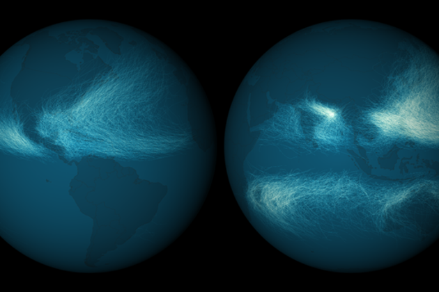
The National Oceanic and Atmospheric Administration's National Climatic Data Center is tasked with tracking all of the various storms and weather activity that happens on Earth. Using this wealth of data, the agency has released a stunningly beautiful map of 11,967 tropical cyclones from 1842 to 2012. The path each storm took from inception to when it died off has been plotted on the earth, resulting in densely-packed spider webs crawling across much of the planet's oceans. On a practical level, the map demonstrates to researchers exactly where the most storms occur and the most popular paths that they take. For the rest of us, it's a beautiful representation of data that affects the lives of millions of people every year.
via The Verge - All Posts http://www.theverge.com/2013/8/26/4660746/noaa-plots-nearly-12000-hurricanes-on-a-beautiful-map-globe
No comments:
Post a Comment