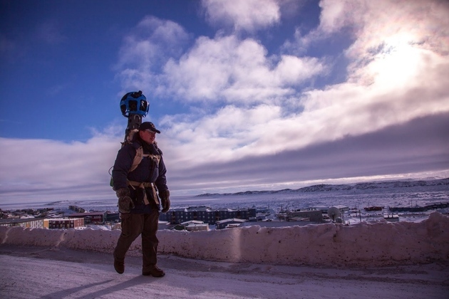
Google has been showcasing its Trekker Street View backpack's abilities with imagery from exotic off-road locales, and one of its next unlikely displays will be from another trip into the Arctic. The company recently sent a small mapping team to Iqaluit, an Arctic city of 7,000 people located in a Canadian territory to the west of Greenland. The Guardian reports on the team's work in the town, from hiking along snow-covered trails with the 30-pound Trekker strapped to their backs, to patching holes in the existing satellite imagery, to enlisting the help of locals to plot businesses and homes without listed addresses. The team spent four days in Iqaluit, and the Street View photographs that it gathered should be online this July.
via The Verge - All Posts http://www.theverge.com/2013/3/29/4161396/mapping-the-arctic-with-google-street-view
No comments:
Post a Comment